|
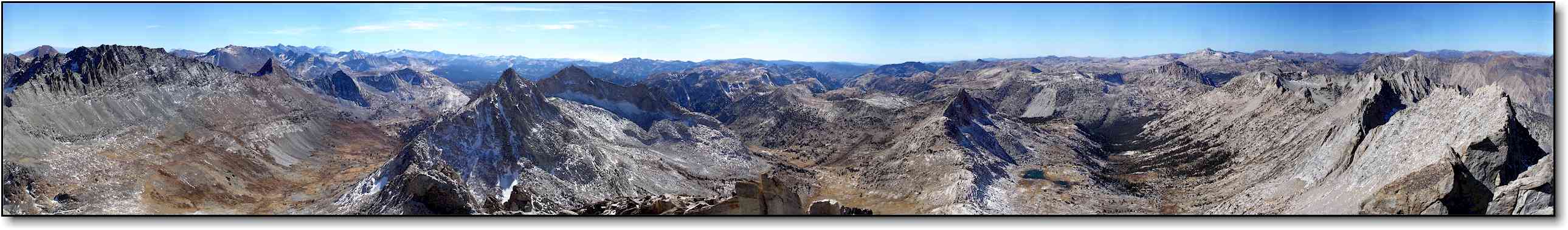
Matterhorn Peak - View from the summit, looking West Looking toward Yosemite N.P. Click on the image above for an even bigger one. Click here for a quick time movie of above image with landmarks listed ** If you have a programmable Garmin GPS, you can download our track here (Twin Lakes to Matterhorn Peak, GDB file) |
|||||||
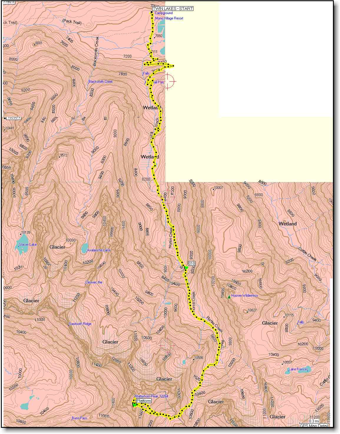
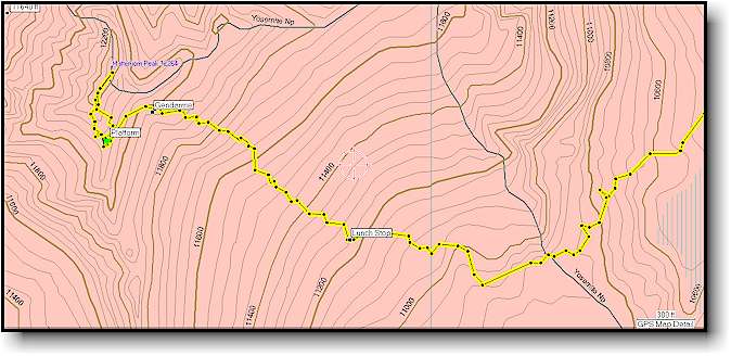
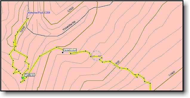
Topo with the route (rotated for better viewing)
Click on image above for a really big one (not rotated and 228 Kb.) |
|||||||
|
|||||||
|
|||||||
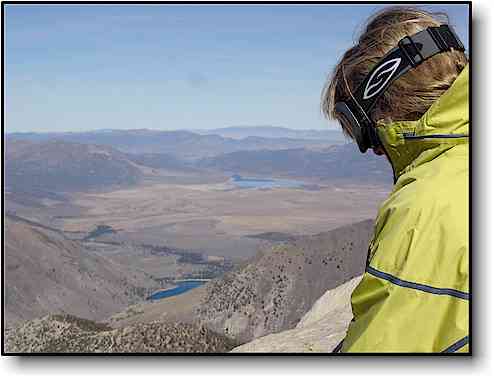 |
View from the summit looking East. In the foreground is the upper Twin Lake and off in the distance is Bridgeport reservoir. | ||||||
|
|||||||
| Go to our home page | See the Matterhorn Peak movie here |